
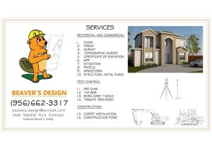
Beaver’s Design Call or Text (346) -855-4175
Our Services
PLANS
PERMITS
RESIDENTIAL & COMMERCIAL
Call Us For Any Information
Architectural Drafting Services and Architectural Construction Drawings.
An architectural drawing is a technical drawing of a building project. Architectural drawings are used by architects and others for a number of purposes: to develop a design idea into a coherent proposal, to communicate ideas and concepts, to convince clients of the merits of a design, to enable a building contractor to construct it, as a record of the completed work, and to make a record of a building that already exists.
An architectural plan is a design and planning for a building, and contain architectural drawings, specifications of the design, calculations, and other documentation. We at Beaver’s Design provide comprehensive documentation service at all stages of architectural design. The value addition comes from our understanding of Building types, Construction types, and knowledge in Building Codes. We recognize that the key to our success is collaborating with our clients to help them market their services so they can spend more time on what they do best. Our 2D architectural drafting services include architectural 2D drafting and detailing for a single family to large residential & commercial buildings, tenant improvement and construction projects. We offer highest quality architectural drafting services including house plans, construction drawings or working drawings.
Years Established
Completed Projects
Site PlanS/Plot PlanS for Permits

RESIDENTIAL SITE PLANS

COMMERCIAL SITE PLANS
")
SUBDIVISION
DRAFTING SERVICES

ELEVATION PLAN

FLOOR PLAN

SUBDIVISION
We’ve Been Building For Over 10 Years
Call For a Quote:
ENGLISH: 346-855-4175
SPANISH: 956-662-3317
Basic Site Plan
- Dimensions of the Lot.
Distance Between Structures.
Main Structures.
Names of Adjacent Street(s).
North Arrow.
Parcel Map.
Property Lines.
Property Owner Information.
Satellite Image.
Scale.
Fence.
Landscape.
Lawn.
- Vicinity Map.
- Property Area.
Standard Site Plan
- Dimensions of the Lot.
- Distance Between Structures.
- Main Structures.
- Names of Adjacent Street(s).
- North Arrow.
- Parcel Map.
- Property Lines.
- Property Owner Information.
- Satellite Image.
- Scale.
- Fence.
- Global Coordinates.
- Landscape.
- Lawn
- Vicinity Map.
- Property Area.
- Sidewalks.
- Shrubs.
- Trees.
- Deck.
- Driveways
Premium Site Plan
- Dimensions of the Lot.
- Distance Between Structures.
- Main Structures.
- Names of Adjacent Street(s).
- North Arrow.
- Parcel Map.
- Property Lines.
- Property Owner Information.
- Satellite Image.
- Scale.
- Fence.
- Global Coordinates.
- Landscape.
- Lawn.
- Vicinity Map.
- Property Area.
- Sidewalks.
- Shrubs.
- Trees.
- Deck.
- Driveways.
- Custom Site Plans.
- Easements*.
- Parking Spots.
- Porch.
- Septic Tanks**.
- Setbacks***.
- Swimming Pool.
- Wells**.